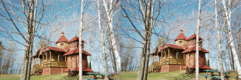
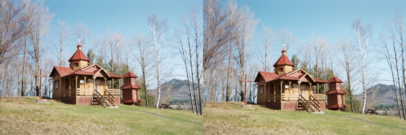
These are "relaxed" and "cross eyed" 3D images,
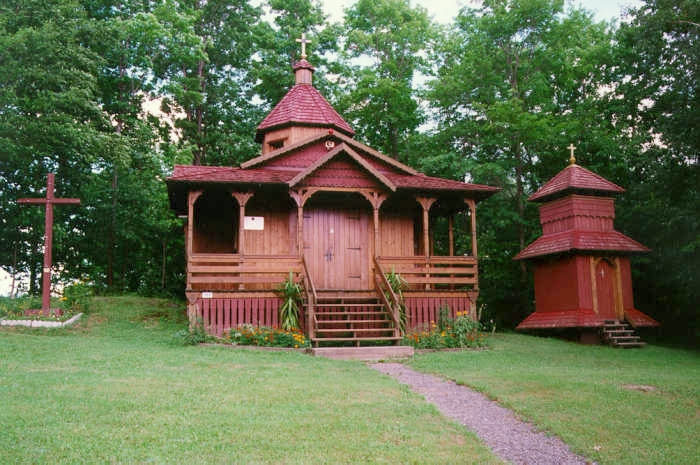
from early May 2003, of the chapel and grounds.
In the first set of images, in the distant right, you can see Mount Owl's Head (or Owls Head or Owlshead).
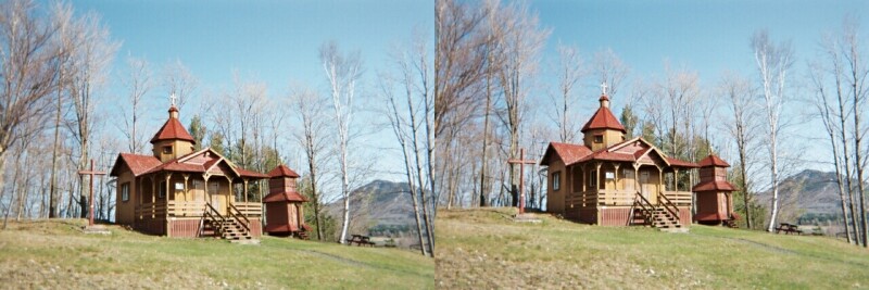
These two are "relaxed" 3D images.
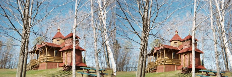
These two are "cross eyed" 3D images.
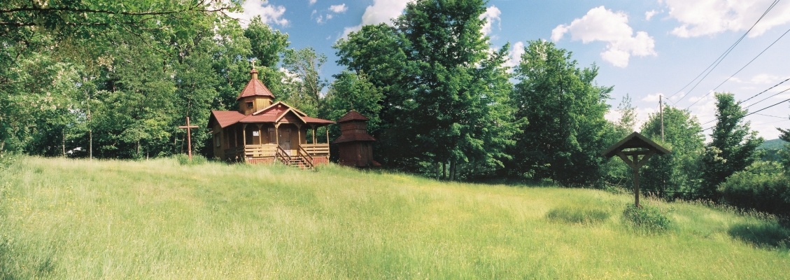
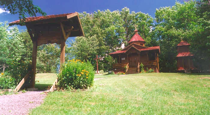
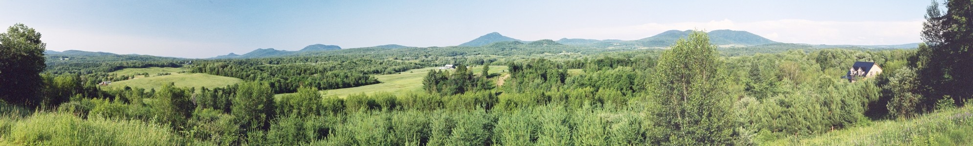
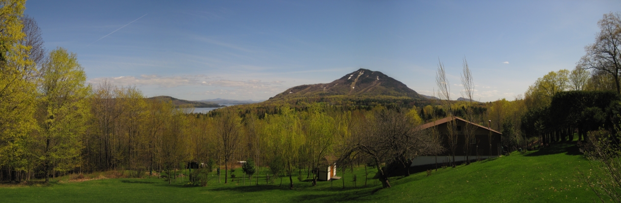
A stitched panoramic view of the chapel and grounds in late June, 2007 - before the road work.
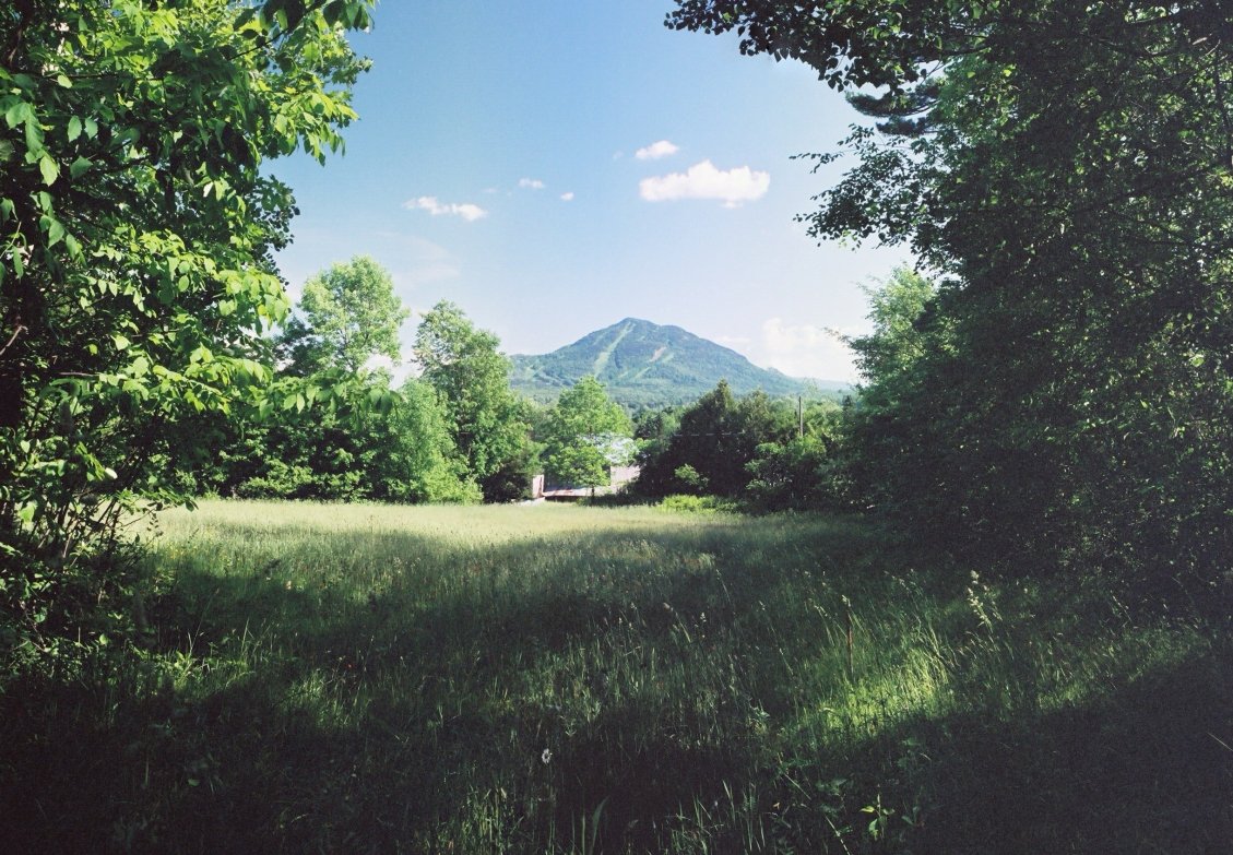
A stitched panoramic view of Mount Owl's Head (or Owls Head or Owlshead),
taken from the chapel grounds in late June, 2006.
The peak is approximately 2450 feet / 747 meters above sea level.
This view shows the north side of the mountain.
The mountain is called Walowadjo in the Abenaki (W8benaki) language:
"walo" = saw-whet owl (aegolius acadicus); "wadjo" = mountain.
It is also called Waloimudupsek: "walo" = saw-whet owl (aegolius acadicus);
"imudups" = head; "ek" = location.
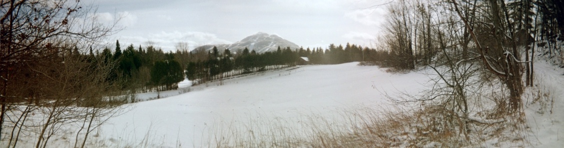
Another stitched panoramic view of Mount Owl's Head,
taken near the chapel grounds in late November, 2007.
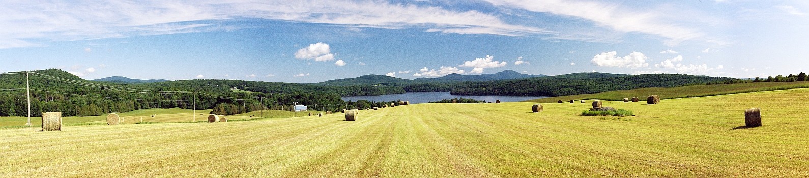
A stitched panoramic view of the hayfield, after the first cutting, just to the south of Knowlton's Landing, July 3, 2008.
In the background is Sargent Bay, a part of Lake Memphremagog. Mount Orford is in the distance at the right.
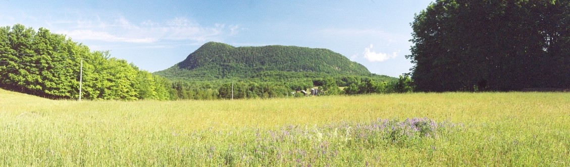
A stitched panoramic view of Mount Elephantis (also spelled "Elephantus"), July 3, 2008.
The peak of Mont Elephantis is approximately 2160 feet / 657 meters above sea level.
This view shows the southern face of the mountain.
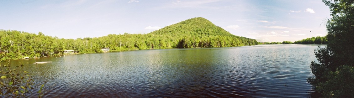
A stitched panoramic view of Sugarloaf Pond and Mount Elephantis (Elephantus),
which is to the south of the pond, July 3, 2008.
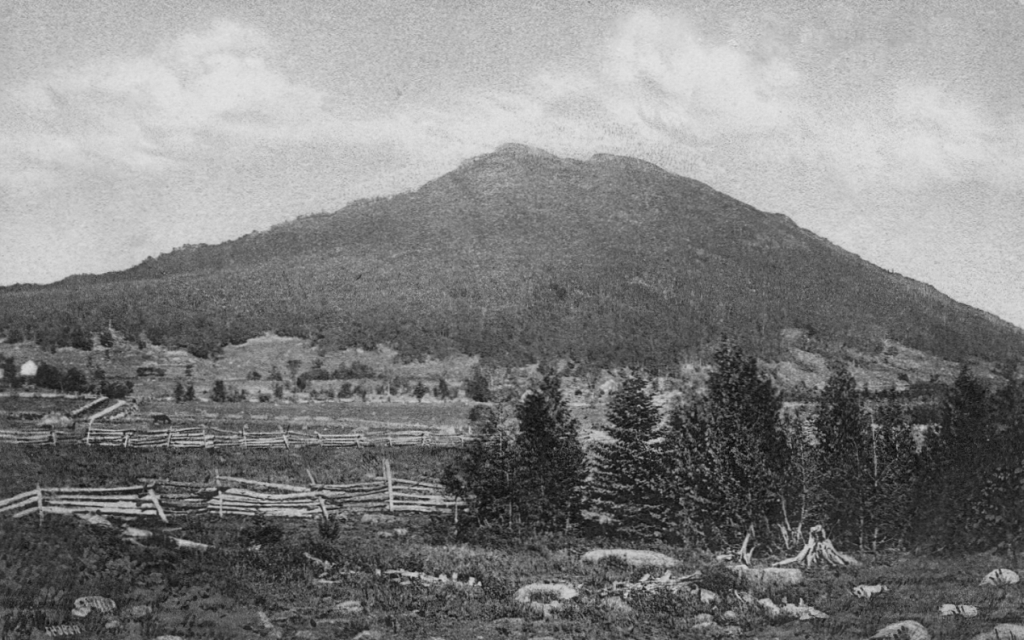
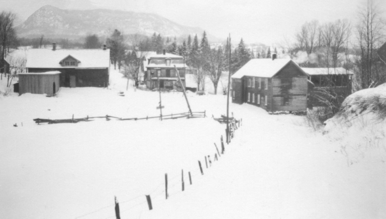
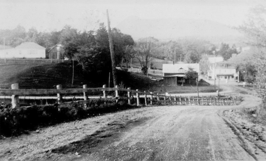
A view from about 1908 of Mount Owl's Head from the west, showing the north and south peaks. Of interest in the fields are the wood rail fences.
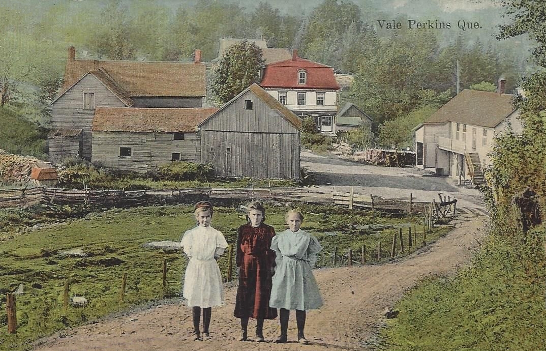
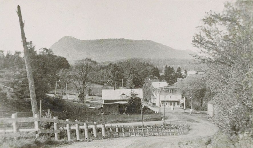
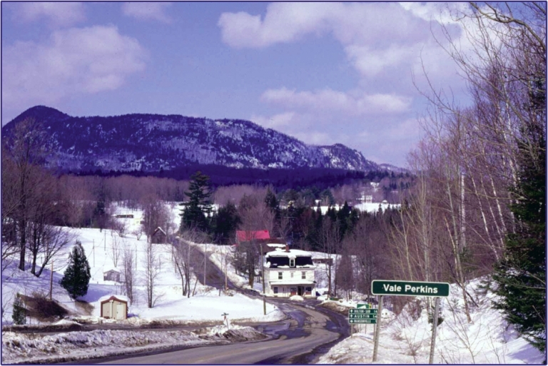
A postcard of Vale Perkins in the late 190x's, showing the view to the north.
When that photo of this bustling metropolis was taken is not known.
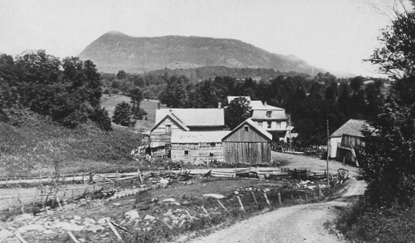
A postcard of Vale Perkins in 1919. Prominent in the background in Mount Elephantis (Elephantus)
and Hog's Back. The peak of Hog's Back is approximately 1742 feet / 531 meters above sea level.
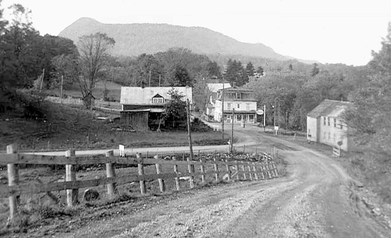
Although it is some ten years later than the card above, not much has changed in the Vale.
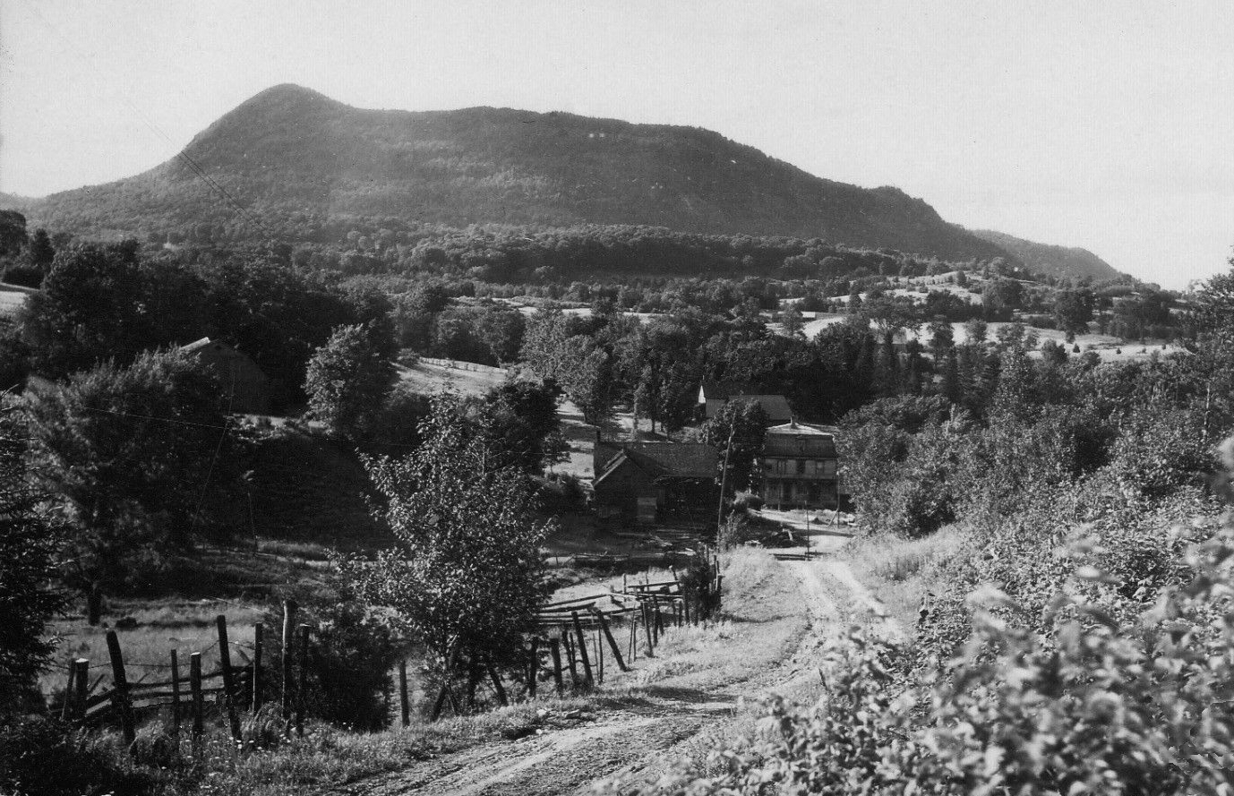
A view of Vale Perkins in 1931, with Mount Elephantis (Elephantus) and Hog's Back prominent in the background.
During the preceding ten years, there have been some changes.
A view of Vale Perkins in 1934, with Mount Elephantis (Elephantus) and Hog's Back in the snowy background.
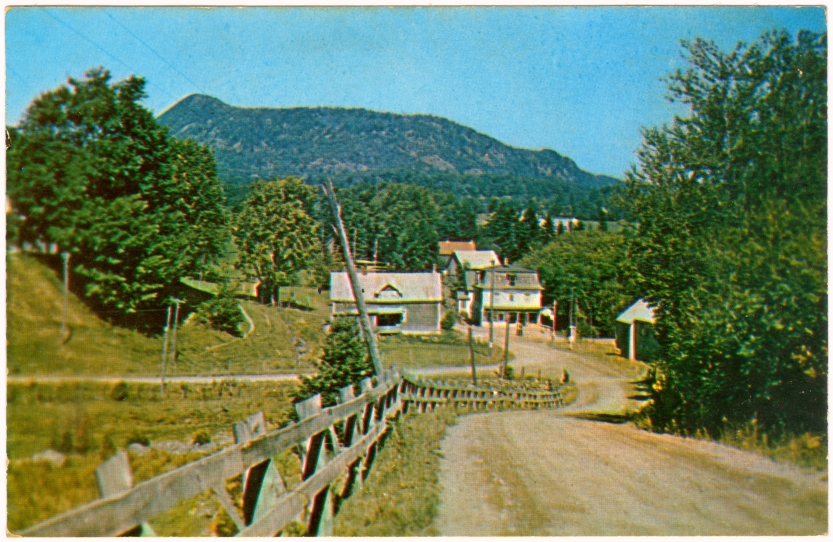
A postcard view of Vale Perkins in the 1950's, with Mount Elephantis (Elephantus) in the background.
What looks like a dead tree on the left side is a pole carrying the electric power lines.
Vale Perkins in the 1950's - prominent in the background is Mount Elephantis (Elephantus) and Hog's Back.
The back of the postcard states: "Kodachrome by L. Dozois", "Made in U.S.A.",
"Published by Thatcher Winger Associates Ltd., Utterson, Ontario", "46057",
and the size is 5 1/2 inches by 3 1/2 inches.
A view of Vale Perkins in the mid-1950's - Mount Elephantis and Hog's Back are in the background.
Another postcard of Vale Perkins in the 1950's - on the left is the house on the hill and the barn, both of which are still there.
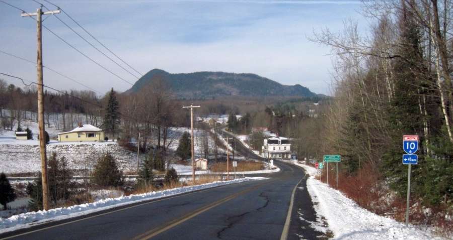
Fifty years later, much has changed in Vale Perkins (shown in approximately 2006).
Still prominent in the background is Mount Elephantis (Elephantus) and Hog's Back.
Vale Perkins in November, 2011, four years after the road was paved.
Mount Elephantis (Elephantus) and Hog's Back remain prominent.
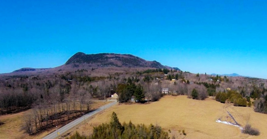
A view of Mount Elephantis and Hog's Back in March, 2016. To the left is
the mountain ridge that is west of Sugar Loaf Pond. In the distant right is Mount Orford.
A stitched panoramic view showing the Sutton mountains, the North Mississquoi River valley,
Peewee (in South Bolton), Elephantis, Owl's Head, Hawk, and Bear,
as seen from near Highwater, looking to the north, on July 2, 2008.
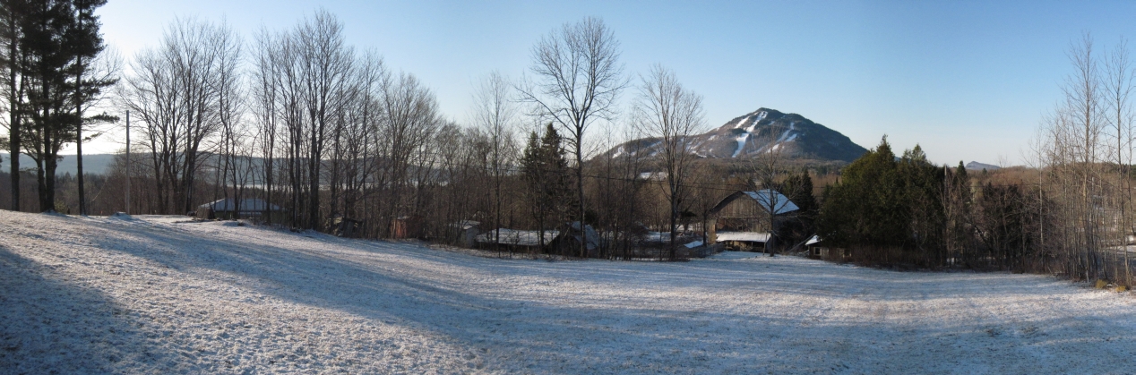
A stitched panoramic view of a snowy Mount Owl's Head.
Mount Hawk is visible to the right and a still ice-covered Lake Memphremagog
is just visible through the trees on the left.
Taken near the chapel grounds early on the morning of April 22, 2011.
Mount Hawk is approximately 1762 feet / 537 meters above sea level.
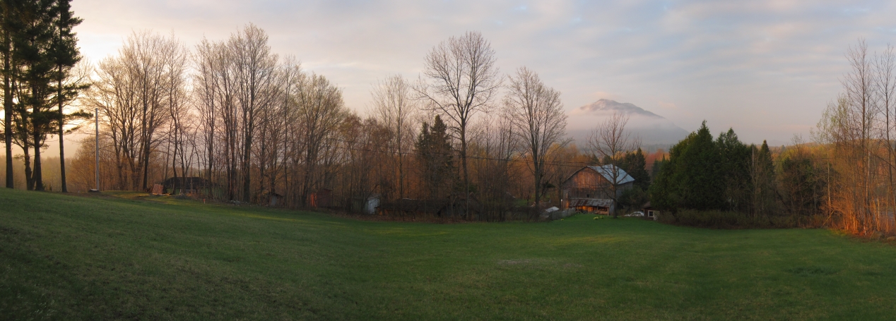
A stitched panoramic view of the fog and low clouds on the morning of May 8, 2011.
The peak of Mount Owl's Head is just visible.
Taken near the chapel grounds.
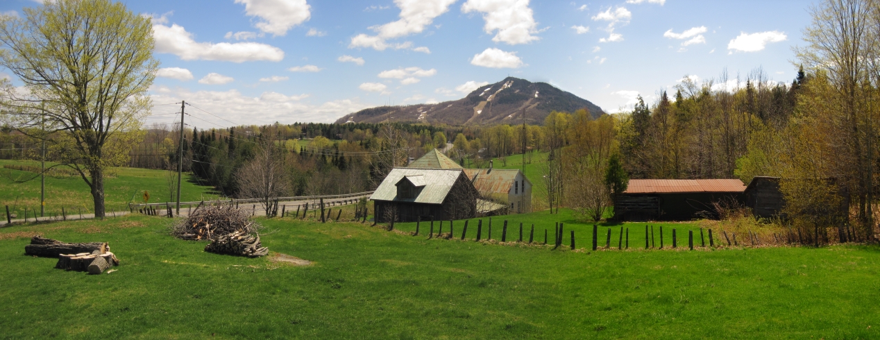
A stitched panoramic view of Mount Owl's Head
in the early afternoon of May 8, 2011. The barn in the foreground, and
the house behind it, were used in the 1998 movie "Free Money"
(with Marlon Brando, Charlie Sheen, Thomas Haden Church, and Christin and Holly Watson).
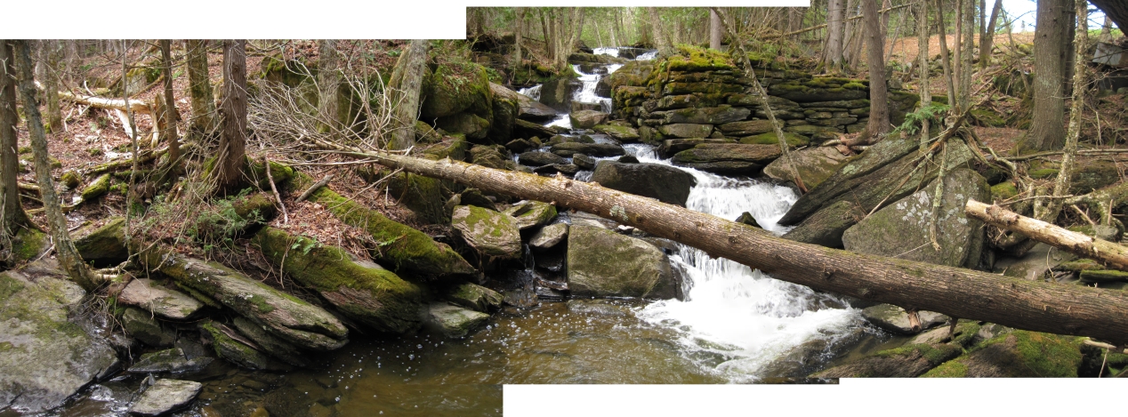
A stitched panoramic view, taken on May 10, 2011, of the mysterious stone
foundations found at the Vale Perkins Brook on the former Harry Jones farm.
No one has taken credit for this mill site, so it remains a mystery...
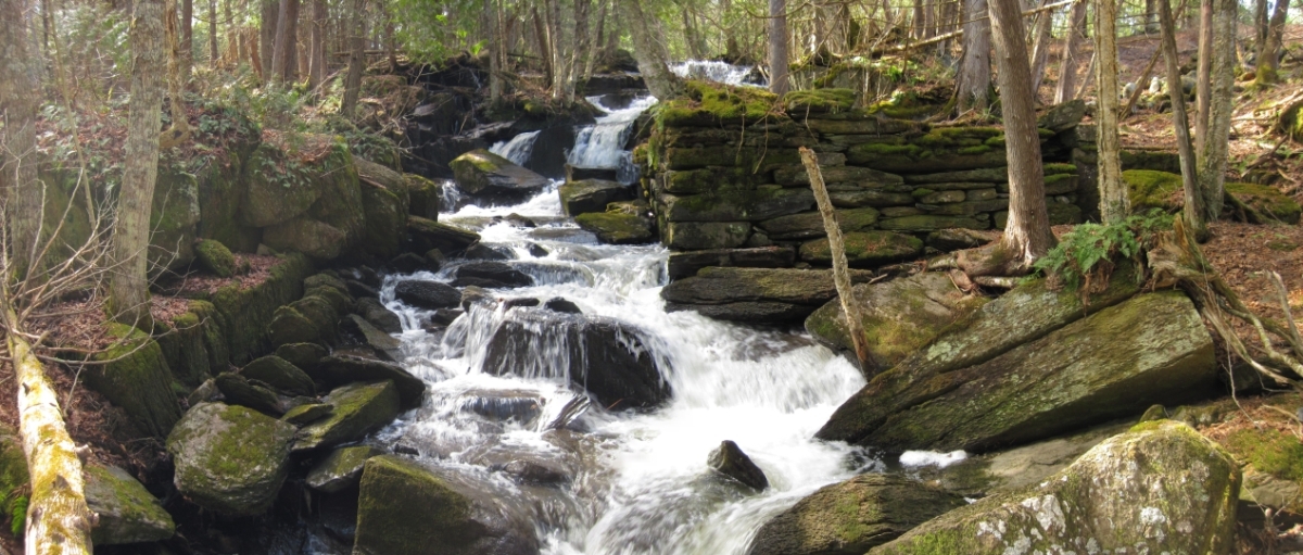
A stitched panoramic view, taken on March 23, 2012, of the mysterious stone
foundations found at the Vale Perkins Brook on the former Harry Jones farm.
On the left side are stones, stacked like fallen over dominoes, that appear
to have been cut for, but never used in, the construction of this mill.
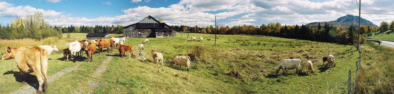
A stitched panoramic view, taken on October 9, 2008, of cows at the former Harry Jones farm.
Mount Owl's Head is off to the right.
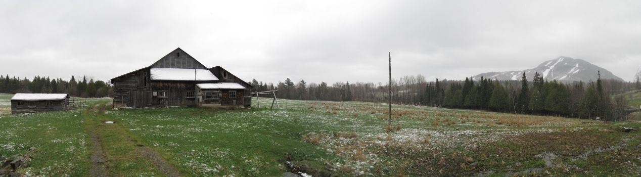
A stitched panoramic view, taken on April 10, 2009 of the light snowfall on the former Harry Jones farm.
Mount Owl's Head is off to the right.
A stitched panoramic view of Mount Owl's Head (Walowadjo), taken near the chapel grounds
on the afternoon of May 12, 2011. Lake Memphremagog (also known as Memrahabegek)
is visible on the left. In the distance are the Green Mountains of northeastern Vermont.
Just to the left of Owl's Head is the Willoughby Gap, where Lake Willoughby, Vermont
is framed between Mount Pisgah (2785 feet / 849 meters) and Mount Hor (2500 feet / 762 meters).
Those two peaks are approximately 28 miles / 46.5 km away.
To the right of Owl's Head are Mount Bear and Mount Hawk.
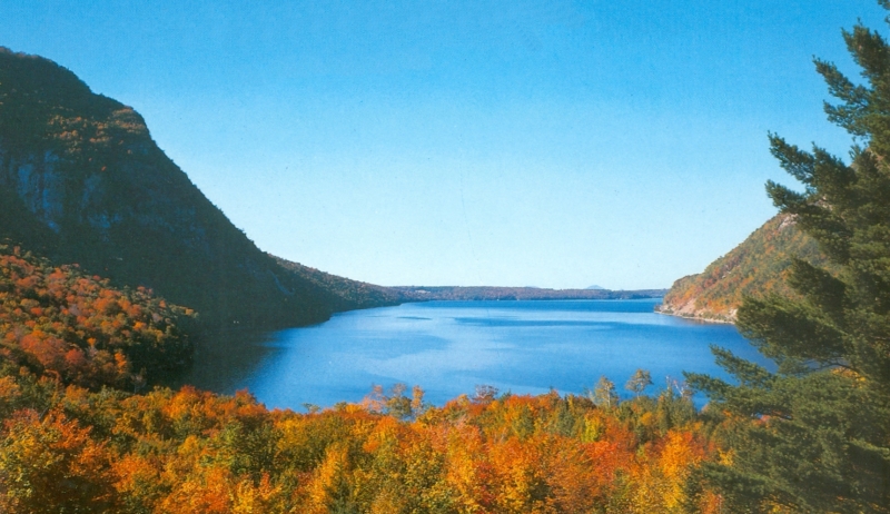
This postcard view of Lake Willoughby looks north. Framed between Mount Hor on the left (west) and
Mount Pisgah on the right (east), Mount Owl's Head is visible on the horizon (near the right edge of the lake).
Mount Owl's Head is approximately 28 miles / 46.5 km north of Lake Willoughby.
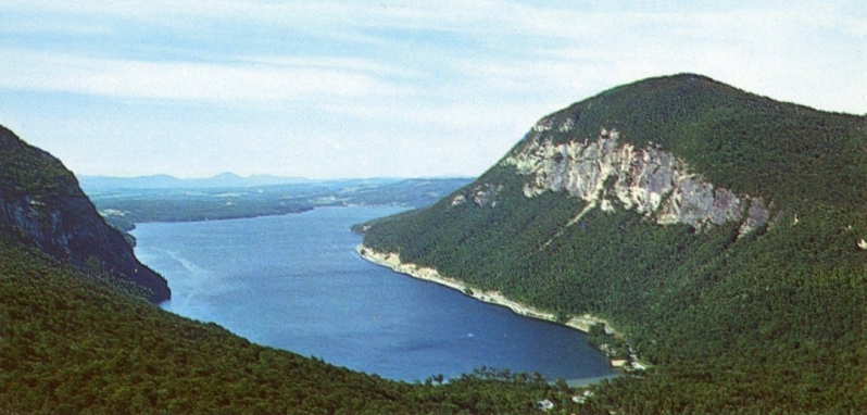
Another postcard view of Lake Willoughby, looking north.
Mount Bear, Owl's Head, Elephantis, and Hog's Back are visible
in the blue haze on the horizon, to the right of Mount Hor.
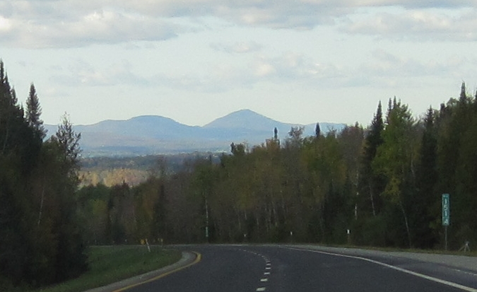
Mount Bear, Mount Owl's Head, and Hog's Back as seen from mile 151.35 on Interstate 91 North.
Owl's Head is approximately 28 miles / 45 km away. The two peaks of Mount Bear are
approximately 2060 feet / 628 meters and 2182 feet / 665 meters above sea level.
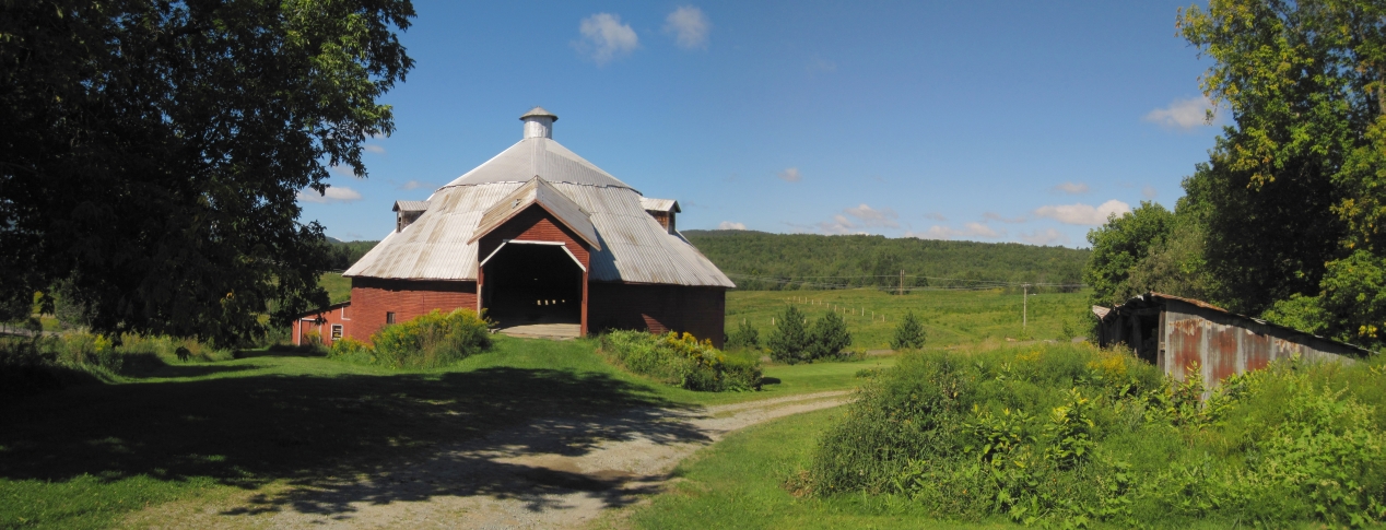
A stitched panoramic view of the round barn in Mansonville, taken on August 20, 2010.
This round barn is located approximately 12 km (7 miles) from the chapel.
The round barn was built by Guy White in 1911 - 1912 for Robert Jersey.
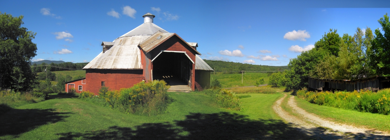
A second stitched panoramic view of the round barn in Mansonville.
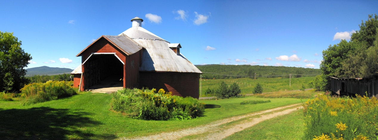
A third stitched panoramic view of the round barn in Mansonville.
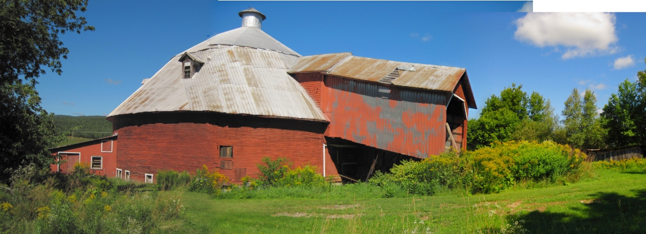
A fourth stitched panoramic view of the round barn in Mansonville, showing the southern side of the barn.
The covered bridge leads up to the hay loft. This is the last remaining round barn in Potton.
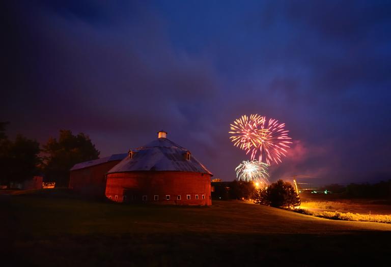
A view of the round barn in Mansonville on August 11, 2012, with the
fireworks from the Multicultural Festival providing the background.
La grange ronde de Mansonville et feux d'artifice dans le 11 Aout 2012.
Image courtesy of inodeestrie.
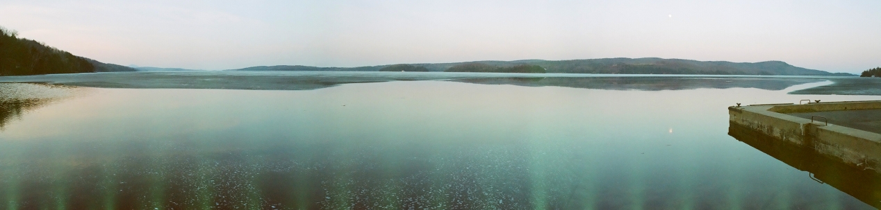
A stitched panoramic view of Lake Memphremagog, looking north from Perkins Landing. There is still some ice on the lake and the moon is rising - April 18, 2008.
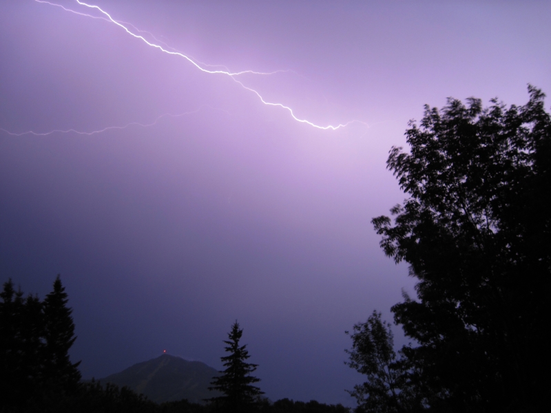
Bolts of lightning over Mount Owl's Head on July 3, 2011.
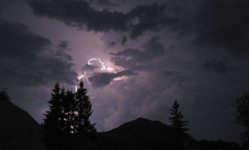
A lightning bolt near Mount Owl's Head on July 21, 2011.
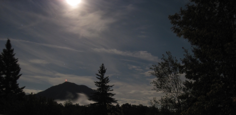
Misty midnight moonlight around Mount Owl's Head on July 2, 2012.
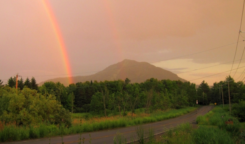
A double rainbow appeared in front of Mount Owl's Head after the evening shower on July 5, 2014.
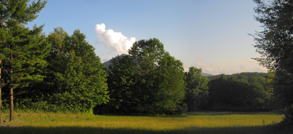
Mount Walowadjo, a usually dormant volcano, is located in Potton on the western shore of Lake Memrahabegek.
In a rare occurrence, Mount Walowadjo sends out a plume of steam from a vent on its southern face in the late summer of 2013.
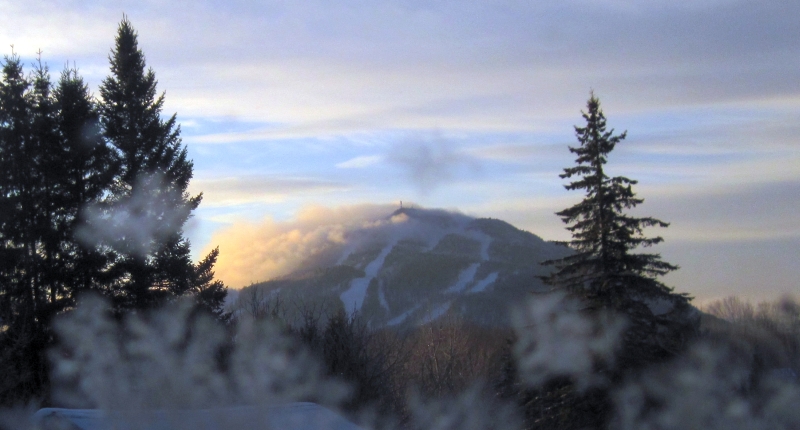
The extreme cold temperatures in late November, 2013 highlight
the steam vents on the northwestern slope of Mount Walowadjo.
This web page is optimized. Please adjust your web browser accordingly.
[ HOME ]